Analysis of the Largest Watershed ofChamoli, Uttarakhand for DEM Purposal
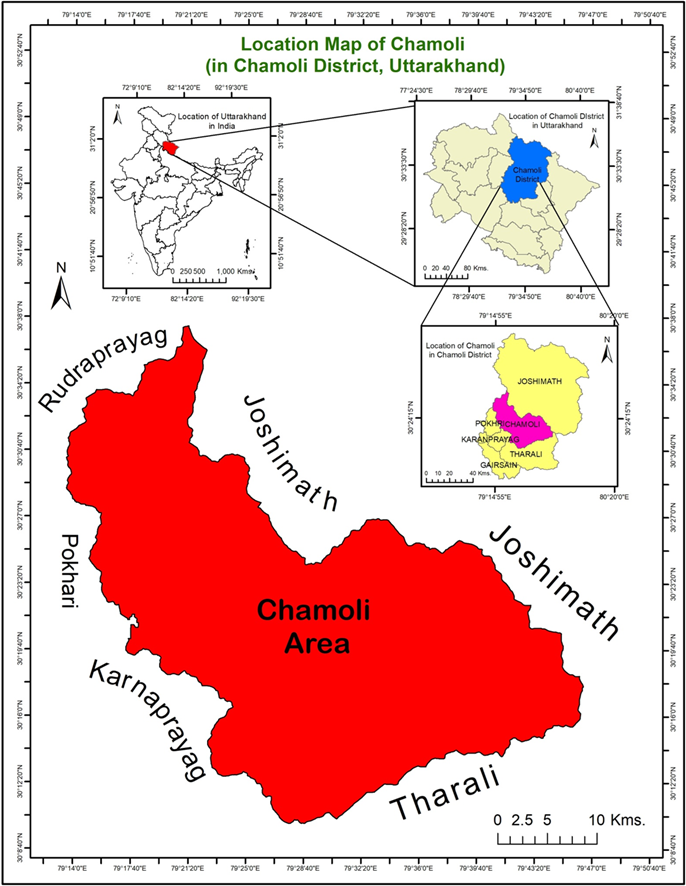
Chamoli is a district of the Uttarakhand state of India. Chamoli is beautified with its scenic landforms
being in the Central Himalayas. It is bounded by the Tibet region to the North and by the Uttarakhand
districts of Pithoragarh and Bageshwar to the east, Almora to the south, Pauri Garhwal to the
southwest, Rudraprayag to the west, and Uttarkashi to the northwest. Lying in the regions of Central
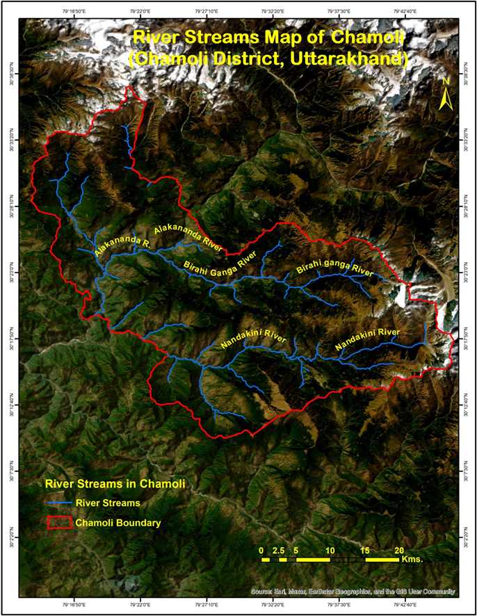
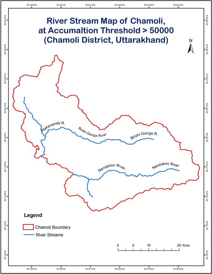
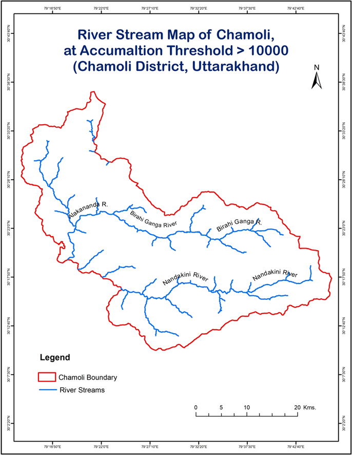
Himalayas, Chamoli witnesses many beautiful and power Rivers and their Tributaries as: the Alaknanda,
Ramganga, Dhauli Ganga, Birahi Ganga, Nandakini, and Pindar, being a major source of water in the
Northern India.
The main Chamoli area is the Chamoli Tehsil, located in the Chamoli District which hosts the three main
Rivers: Birahi Ganga, Alakananda and Nandakini River. These rivers have numerous tributaries and distributaries
spreaded all over the Chamoli. This area located Himalayas to the plains, supports the
vigorous flow of river forming major Watersheds and Catchment Areas. So, these watersheds can be
used as a purpose to DEM analysis using GIS based studies to know their utility.
GIS based study of these watersheds, can be fruitful for future to know the areas of DEM purpose and
find the areas of Environmental growth, DAM construction, Biodiversity growth, Water feasibility for
drinking, Hydro-Electricity, etc.
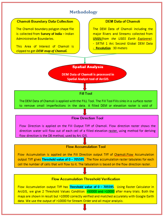
So, we have carried out a GIS based study using ArcGIS softwrare, USGS and Survey of India data in the
Chamoli, mainly in the Watershed of Birahi Ganga, Nandakini and Alakananda River to analysis their
geographic significance for DEM purposal.
Conclusion
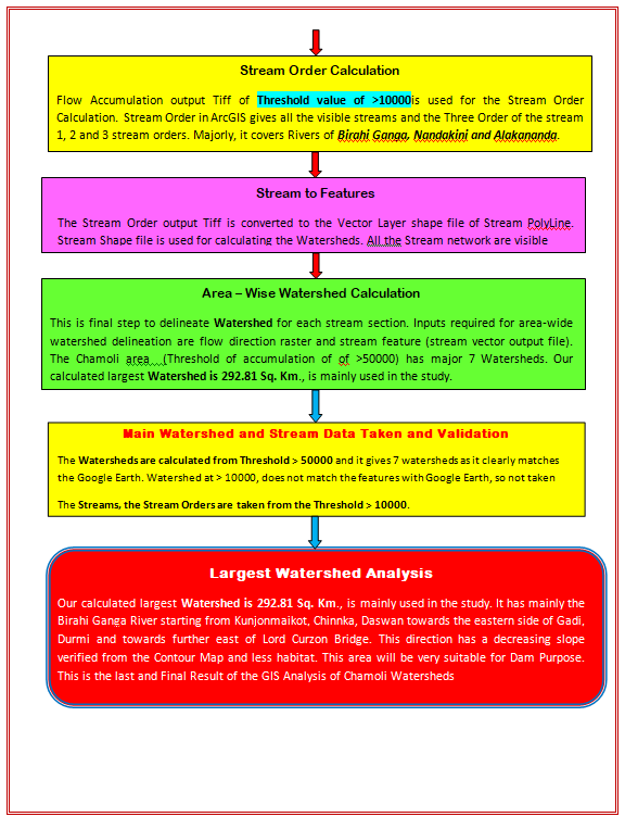
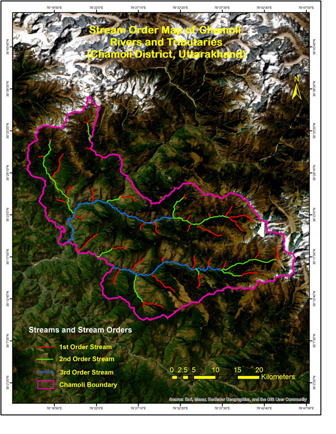
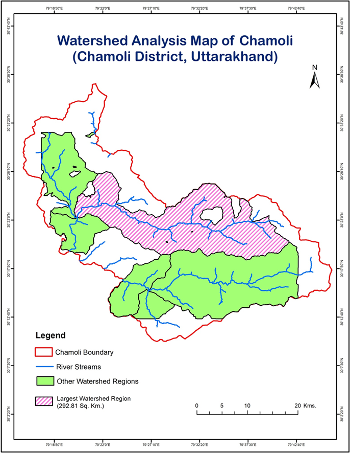
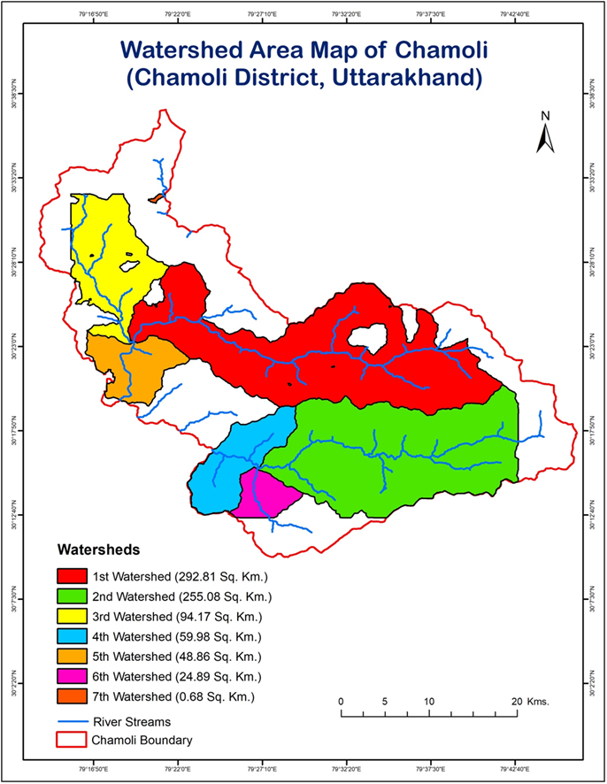
Using the GIS and Spatial Hydroshed analysis approach we have successful analyzed and interpreted Largest Watershed of Chamoli, Uttarakhand for Dam proposal. This Largest Watershed area with 292.81 Sq. Km extending along the Birahi Ganga River is the best Watershed for the Dam proposal in the Chamoli area.
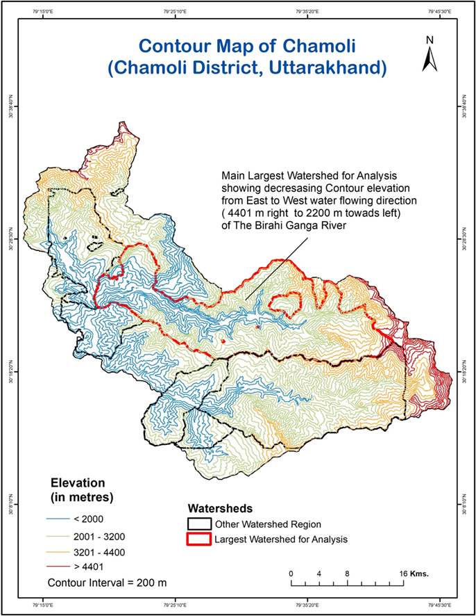
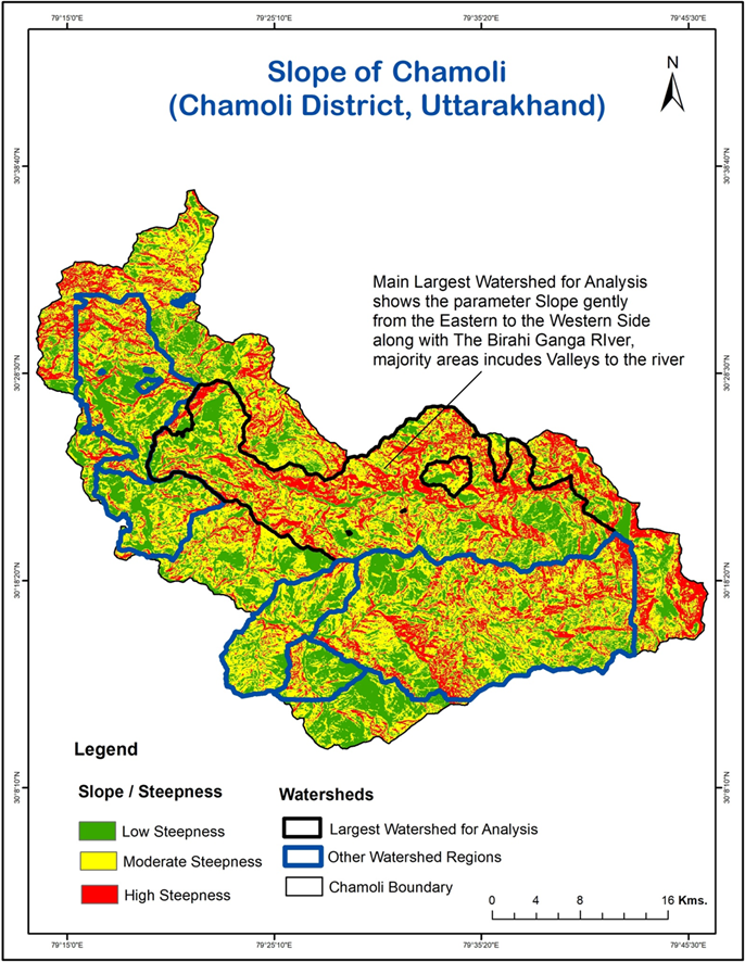
GIS made us enabled to study each minute detail of the area, starting from the small stream, their accumulation threshold value, flow direction, population and habitat analysis of the area, geomorphologic aspect and the feasibility aspect of the Largest Watershed area of the Chamoli.
The Largest Watershed area includes the area of Kunjonmaikot, Chinnka, Daswan towards the eastern side of Gadi, Durmi and towards further east of Lord Curzon Bridge, with the running Birahi ganga River over Km.
Thus, this study of the area included the Hydro power value, Environment impact, human impact, Geographical impact and taking the positive considerations of all the aspect, this Largest Watershed area has proved to be very valuable for Dam proposal.
So, GIS has fruitfully supported the project to study in depth of this Largest Watershed Area in Chamoli making it effective for the Dam proposal to give the best valuable results.